Best For: Ultra veterans looking for a pure, single-digit elevation gain grind on technical singletrack.
Course Character: Rolling, rocky, and deceptively long.
Logistics Score: ⭐⭐ (Remote, rural Wisconsin; expect dead zones and driving.)
Value for Money: ⭐⭐⭐⭐ (Solid organization for a true wilderness experience.)
---
This isn't a race for people who want paved paths and easy cell service. It is a raw, glacial-carved trail experience that demands respect for the distance and the terrain. If you want to feel truly isolated in the Chequamegon-Nicolet National Forest, this is your playground.
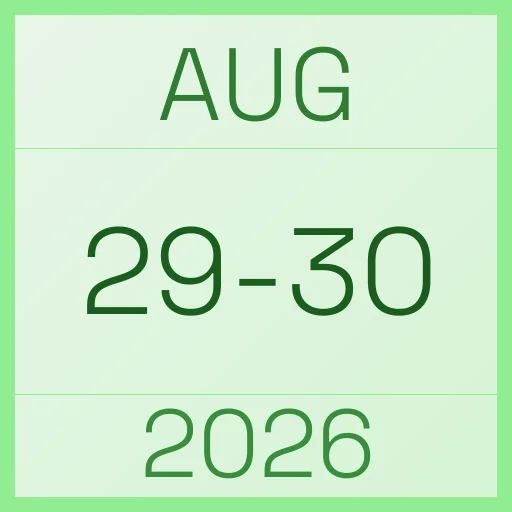
Midwest States 100 2026 takes place on Friday, August 29, 2026, in Westboro, United States. You can choose between the 100-mile, 100K, or 50K distances. This is a pure trail event set within the scenic, rocky landscapes of the Ice Age National Scenic Trail.
What is the terrain and difficulty like?
Don't let the relatively low elevation gain fool you into thinking this is an easy day. The course follows the Ice Age Trail, meaning you are dealing with ancient glacial terrain: rocks, roots, and forest singletrack. The "100 mile" is notorious for measuring long on GPS—expect to actually run closer to 106 miles. It’s a steady, rhythmic grind rather than a mountain sufferfest, but the technical nature of the surface will eat at your legs over 100 miles. You can find the Midwest States ↗ GPX files for all distances here to prepare.
What are my distance options and when do they start?
You have three ways to tackle this: the 100-miler, the 100K, or the 50K. Both the 100-mile and 100K share a 6:00 am start time, which is ideal for getting a good chunk of daylight in early. The 50K is a later affair, starting at 11:00 am. If you want the full, lonely experience of the Ice Age Trail, the 100-miler is the gold standard here.
What should I expect regarding weather and gear?
Late August in Northern Wisconsin is a gamble. You can expect humid, mid-80s temperatures during the day, but the forest canopy provides some relief. The real wildcard is the overnight drop; temperatures in the Chequamegon-Nicolet can dip significantly once the sun goes down. Bring moisture-wicking layers and be prepared for high humidity. Most importantly: download your maps. There is zero cell service on the course, so if you don't have your GPX files ready on your device, you are effectively lost.
How do I handle the logistics and aid stations?
This is a remote race. The aid stations are strategically placed at trail intersections and parking areas (like the Mondeaux parking area and various Route crossings), but you are deep in the woods. You need to be self-sufficient with navigation. For those bringing crews, be aware that communication will be difficult; you'll need to rely on the provided Google Maps ↗ driving maps and pre-planned rendezvous points. For a full breakdown of aid station locations, check this Google Sheets ↗ document.